I use STConvexHull when I need a convex enclosure around a geometry. It fills a shape’s indentations. That enclosure is useful for a defined comparison, but it doesn’t preserve every membership rule of the original shape.

Start with a visible indentation
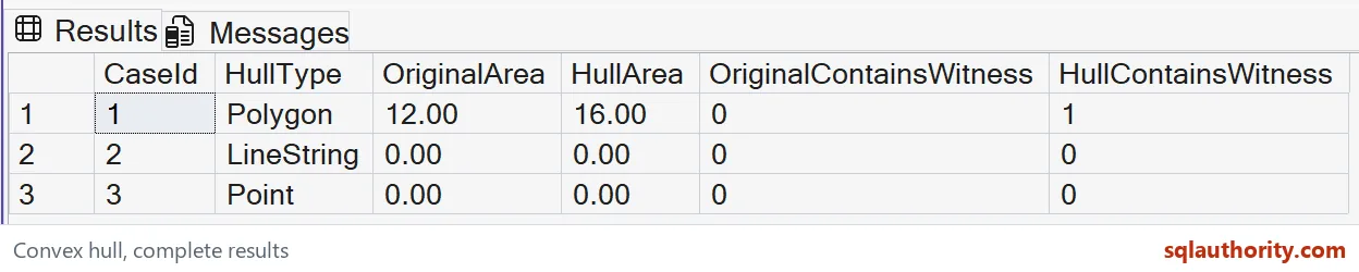
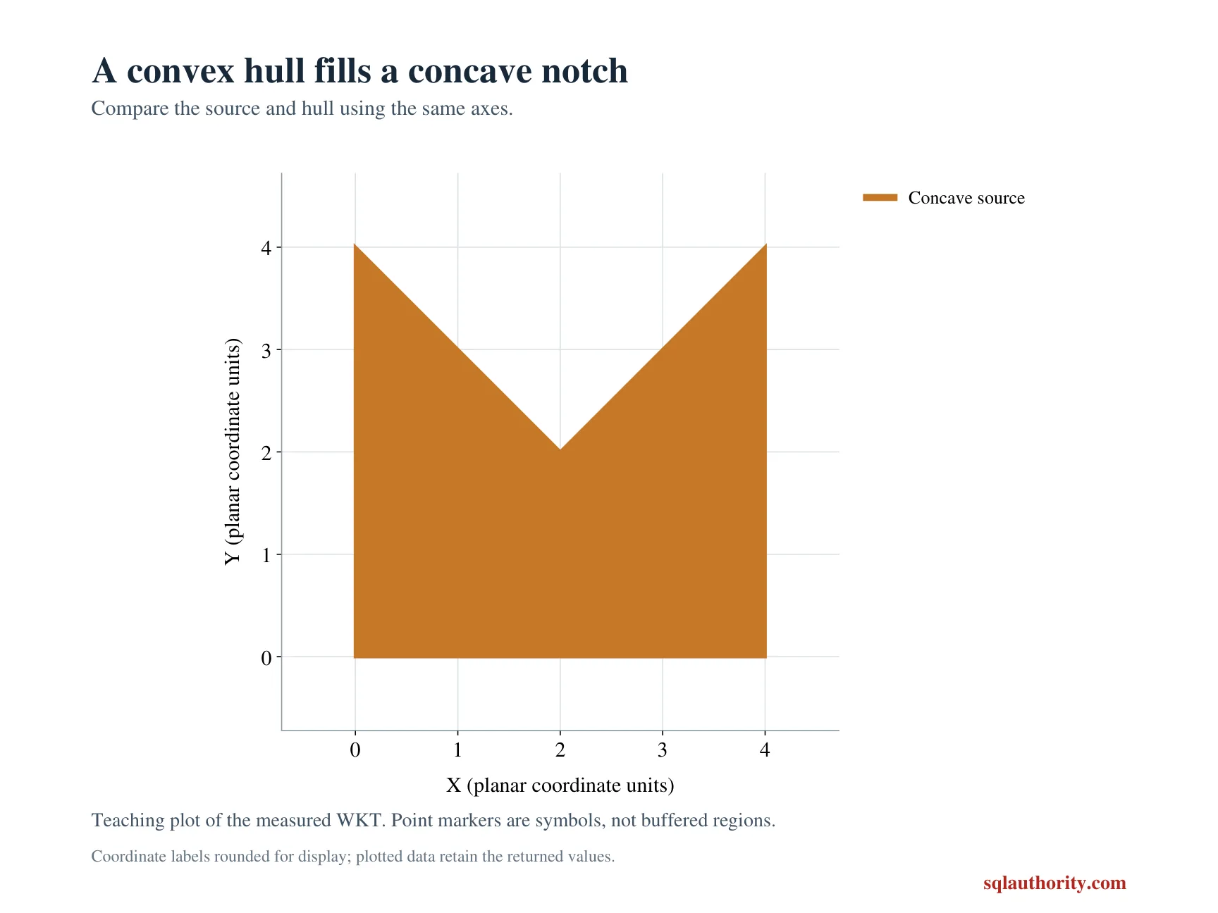
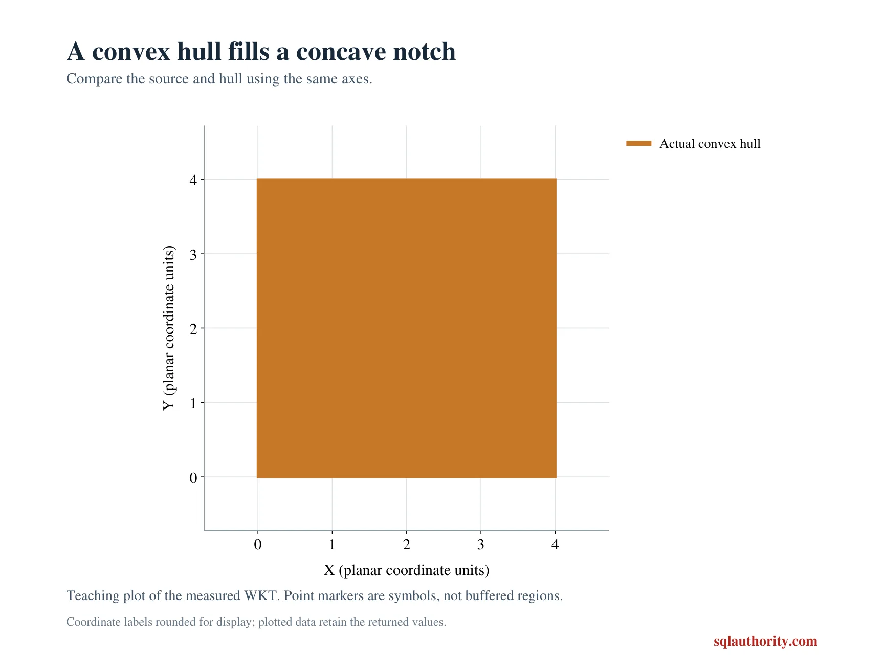
The first input is a square-shaped polygon with a triangular notch at the top. Its vertices run through the inward point at two, two. The expected original area is twelve, while its hull has area sixteen.
I keep the source geometry and the derived hull in separate columns inside the CTE. Nothing is updated or replaced. That separation matters because the larger enclosing region answers a different question. A hull isn’t simply a neater serialization of the original polygon.
WITH Inputs AS
(
 SELECT CaseId, Shape
 FROM (VALUES
  (1,geometry::STGeomFromText('POLYGON((0 0,4 0,4 4,2 2,0 4,0 0))',0)),
  (2,geometry::STGeomFromText('LINESTRING(0 0,2 0,4 0)',0)),
  (3,geometry::Point(0,0,0))
 ) v(CaseId,Shape)
), Hulls AS
(
 SELECT CaseId, Shape, Shape.STConvexHull() AS Hull FROM Inputs
)
SELECT CaseId, CAST(Hull.STGeometryType() AS nvarchar(40)) AS HullType,
       CAST(Shape.STArea() AS decimal(12,2)) AS OriginalArea,
       CAST(Hull.STArea() AS decimal(12,2)) AS HullArea,
       Shape.STContains(geometry::Point(2,3,0)) AS OriginalContainsWitness,
       Hull.STContains(geometry::Point(2,3,0)) AS HullContainsWitness
FROM Hulls
ORDER BY CaseId;
Test a witness in the filled region
The witness point lies at two, three. It lies inside the notch, so it is outside the source polygon but inside the convex enclosure. The expected membership columns therefore change from false to true for case one.
I’d show that witness beside the area comparison. Area alone can reveal growth without showing how a query’s answer changes. A location admitted by the hull may still be outside the true service region. Retain the original geometry for decisions needing exact membership.
Handle lower-dimensional inputs
The second input is a collinear LineString. The third is a Point. The hull of these inputs keeps their type: a line stays a line and a point stays a point. They don’t become artificial polygons merely because the method is commonly explained using polygon examples.
Both expected areas are zero for these cases. Neither contains the chosen witness. I’d inspect the returned type before sending a hull to a consumer that assumes a polygon. A successful method call doesn’t establish that consumer’s required shape type.
Choose properties that express the contract
The query reports geometry type, two areas and two membership results. It doesn’t depend on a specific starting vertex in a serialized hull. Those properties directly demonstrate the enclosure and its changed region.
I’d compare complete output tuples rather than accepting an attractive spatial preview alone. A plotted outline can hide small coordinate or membership mistakes. Explicit witnesses make the intended decision reviewable. The display remains useful, but it doesn’t replace the numeric and Boolean evidence.
Keep the coordinate model clear
All inputs use geometry with SRID zero. The areas are planar coordinate-square units, not automatically square metres or geographic surface areas. The coordinate values were chosen for transparent arithmetic in a small example.
I’d identify a real dataset’s coordinate system before interpreting an area as a physical measurement. Assigning a familiar unit label doesn’t transform coordinates. This lesson describes the enclosure operation. It doesn’t establish a projection or a conversion between geographic and planar data.
Use the hull for a specific purpose
The method returns another geometry value, so it can feed a subsequent read-only spatial expression. A hull may help summarize extent or define a broader candidate region. Its filled spaces still require conscious treatment.
I’d keep exact membership checks separate when the application’s decision depends on the original outline. This example makes no performance claim or index recommendation. A smaller expression isn’t automatically a faster complete query. Validate the geometric question first, then inspect the production workload separately.
Keep the original shape close, because the hull can admit points it excludes.
A convex hull is not the original shape, it is the smallest convex region around it.
Published by Pinal Dave on SQLAuthority. More of my work at pinaldave.com.
Discover more from SQL Authority with Pinal Dave
Subscribe to get the latest posts sent to your email.